
Secrets of St-Rémy #5: Hiking and Biking

My wife Val and I live part of the year in St-Rémy-de-Provence, a charming town between Marseille and Avignon. I’ve written a guidebook about the area, An Insider’s Guide to Provence, where I share some of our favorite things to see and do. This series of articles is based on that book.
You can read the entire series right here
Secrets of St-Rémy
is a series perfect for your next trip—save it now.
It will take you to the all of best sights, sounds, and aromas of St Rémy
1. Must-see sights
2. Favorite places to eat
3. Favorite Wineries
4. Favorite Boutiques
5. Hiking and Biking
Our Favorite Hiking Trails
Here are two of my favorites, with the second more challenging that the first.
Canal Walks
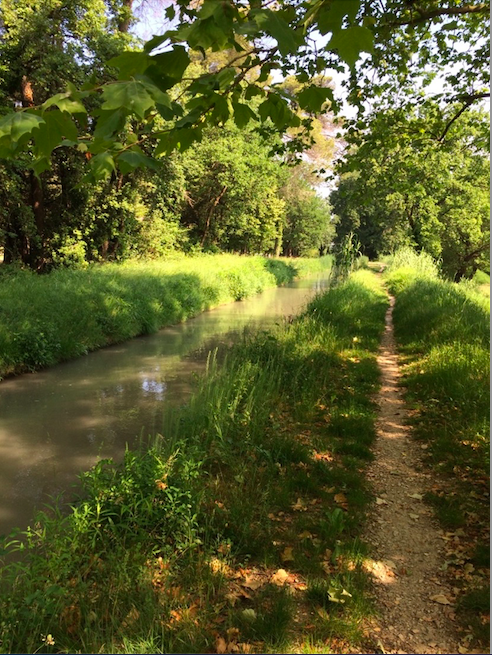
St-Rémy is in an agricultural area with a vast network of irrigation canals, built around the main Canal des Alpines. This canal and its offshoots are like a bunch of little rivers with shady walking paths alongside them.
My favorite starting point is at the waterfall by the road that enters St-Rémy from the east. If you follow the canal upstream about 100 yards you will come to a split. You can follow the path to the left and go a long way, with great views of vineyards and the Alpilles beyond. Or you go to the right towards town, with the occasional peep into someone’s backyard.
Alternatively, you can follow the canal downstream for a mile or so and be rewarded with beautiful views of St-Rémy.
The network of canals extends far beyond St-Rémy. Check Google Maps to trace their path and find a spot to begin your walk. It’s an unbeatable way to get some cool exercise on a hot day.
Up to La Caume
My favorite hike is the one to up La Caume, one of the highest points in the Alpilles, where the views are excellent. I like to start partway up the mountain, at the Parking de la Caume, and hike on the asphalt-covered trails. There is not a lot of shade, so if it’s a warm day start early and take plenty of water.
From the parking lot, head out the back and start walking. The trail is gravel at first but quickly becomes paved. Along the side are occasional signs identifying the plants you are passing. There are a few somewhat steep sections but they are not too bad, except the very last part that will have you huffing a bit.
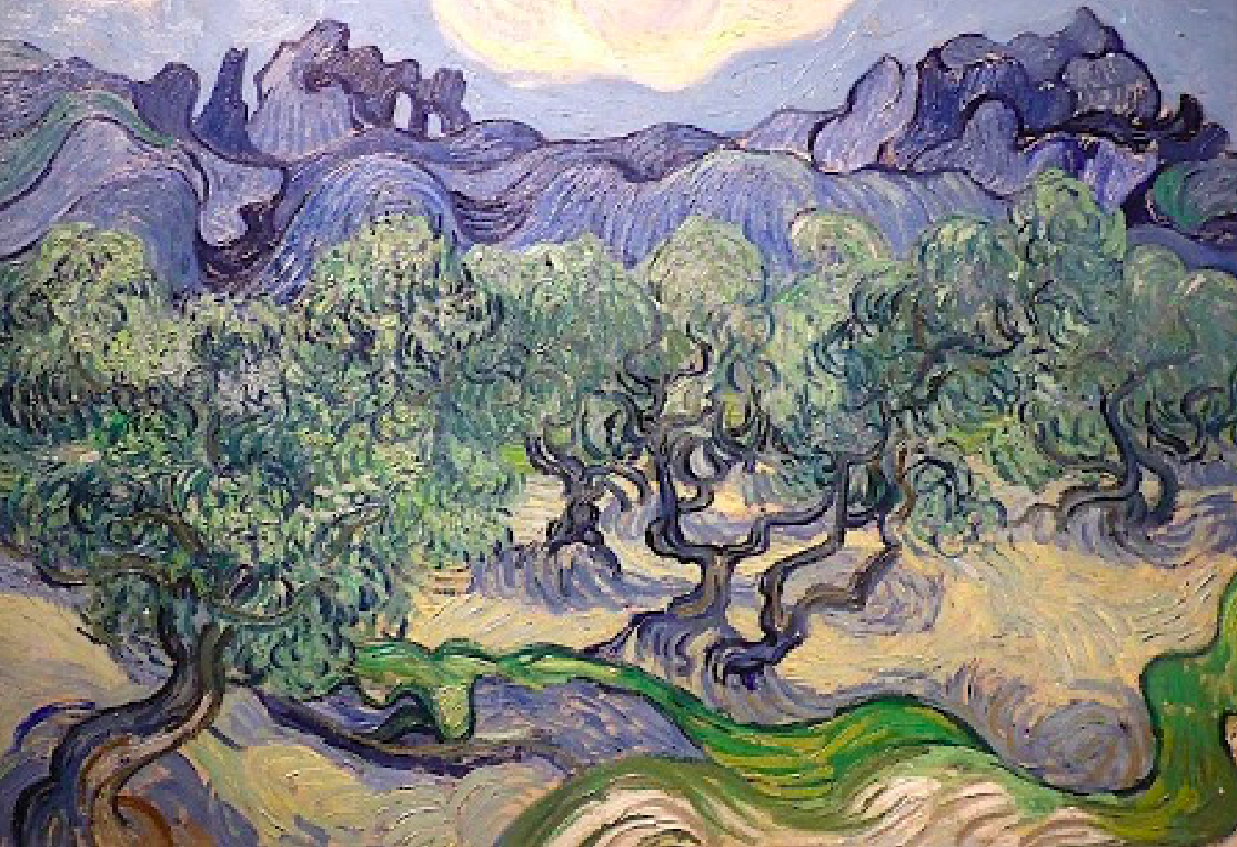
It’s a little more than two miles to the top and takes about 45 minutes each way. Along the route, you’ll get excellent views to the north, over St-Rémy and the surrounding countryside. Near the end there’s a good view of the Rocher des deux trous, the rock with two holes in it that was painted by Van Gogh. You can follow a short dirt trail to see it up close, though the footing at the very end is tricky.
The end of the trail, at La Caume itself, is somewhat marred by a giant communications tower, but the views are fabulous. On a clear day, you can see nearly to the Mediterranean Sea.
Our Favorite Bike Routes
Val and I love to bike in and around the Alpilles, on routes that range from easy to moderately difficult. If you stay off the busy main roads, it is easy and safe, and there are a number of local shops that rent bikes (including electric.)
Here are three of our favorite routes, from easiest to hardest. There are more challenging circuits as well, with markings along the route, and there is lots of mountain biking you can do in the Alpilles—check at the St-Rémy tourist office for more information.
From St-Rémy to the Romanin Glider Airport

The best part is watching the airplanes and gliders take off and land at the airport. You can even book a glider ride if you want! If you look up to the Alpilles, you’ll see one of the best and most beautiful wineries in the area, Château Romanin.
From St-Rémy to Saint-Étienne-du-Grès
This route is about 12 miles round trip and the road is mostly flat. It’s a pretty ride, past orchards and vineyards, and in the springtime you’ll see fields of poppies. The very last stretch is a moderately steep descent so if you don’t want to climb up on the return, turn around when you get to the downhill.
You can see this route on Google Maps.
Partway along is the Calenquet olive mill, maker of some of the best olive oil in France. You can stop and see their operation and taste some olive oil on your way out or back.
To Hell and Back

If you are feeling energetic, you can do some climbing and get one of the best views in Provence at the Val d’Enfer (Hell Valley.) This ride is about 10 miles round trip.
You can see this route on Google Maps.
You start on the same flat path as the one to Saint-Étienne-du-Grès, and then turn off it and start climbing. The ascent gets steeper as you go, with some switchbacks near the top. If you are like me, you might stop a few times to catch your breath.
When you hit the top (hurray!) you’ll get some very nice views off to the right. Enjoy them, then continue straight a few hundred more yards for a great view.** The road will descend steeply and make a sharp right turn. Park your bike at this turn and enjoy a fabulous view of the mountaintop fortress of Les Baux-de-Provence.
You can continue a bit further along the road to see the craggy rock formations that give Hell Valley its name, but be aware that you’ll soon come to the popular Carrières de Lumières immersive art show. This draws a lot of traffic so you might want to turn around before you get here.
**As an alternative to continuing straight after you hit the top, turn left and go up a steep road that goes about a quarter of a mile and then ends. From there, there is a stretch of rock that you walk up for about 50 yards, at the top of which is possibly the most magnificent view in Provence—on a clear day you can see Mont Ventoux, Mont Sainte-Victoire, the Mediterranean Sea, and everything in between.
Do you have any hiking and biking in St-Rémy experiences to share? … or other places in Provence? Please share in the comments section below.
Image Credits
1. Hiking man: Pixabay royalty-free images
2. Canal: copyright Keith Van Sickle
3. Van Gogh painting: public domain
4. YouTube video: Calenquet olive mill
5. Glider airport: copyright Keith Van Sickle
6. Les Baux-de-Provence: Creative Commons License, attribution Benh Lieu Song
Those are great tips!
Living in Aix-en-Provence I stay closer to home and enjoy hiking in Vauvenargue starting at the Barrage de Bimont. From here there are many trails where you can enjoy the views of Mont Saint Victoire and if you’re really courageous you can climb it too!
I must get over to St. Rémy. Sounds wonderful.